Learn tips for navigating the Zartico Interactive Map you've received from our team.
During onboarding, our talented Zartico GIS team, or geospatial information systems team, will develop an interactive map we'll use to visualize your specific Place-Based Set-Up. Using this ArcGIS map, we'll be able to visualize your overall boundary, regions, and all the way down to the primary places of impact (POI) we'll include in your ZDOS®.
By creating this interactive map, your team will have full visibility into what is going into your ZDOS® and will have an opportunity to sign off on all boundaries before we load your full historical location data.
Watch this video for a short tutorial...
You're probably wondering how to navigate this interactive map so we've put together a few tips for you:
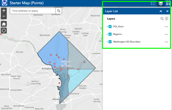
- In the top right, you'll see an icon that looks like a stack of paper. If you click on that, you will reveal the various layers within the map. You can toggle these layers on and off to help view specific layers within the map. This is particularly helpful when you want to isolate a specific layer like POI.
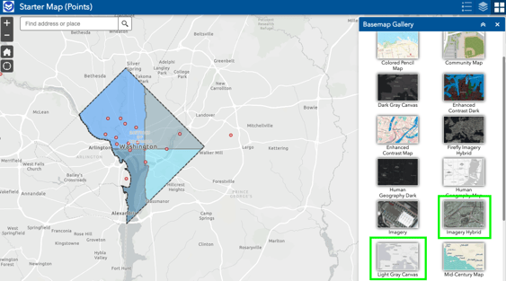
- Also in the top right, you'll see an icon with 4 squares. You can click on that to change the base map. As you'll notice there are numerous options here - we suggest sticking with either the Light Gray Canvas or Imagery Hybrid options.
- At the bottom center of the screen, you will see a down arrow. If you click on that, you can reveal a table with tabs for your various map layers.
Navigating through each of these tabs, you'll see a list of all of the elements within each category. If you double click on a listing in these tabs, it will navigate you to that specific element on the map whether it be a place of impact or region so you can see the boundaries for that element.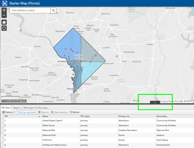
Want to check out a live example of a Zartico Interactive Map? Check out our live Starter Map at this link.
Pro Tip: As you zoom in, the table will display only features within the geographic area you are zoomed into, thus you may not see all places of impact you're expecting to see. Be sure to zoom out fully to display your full place of impact list!